
In the previous post, I described how you can now draw geographic data along with attribute data from within a SharePoint list or library. What other GIS-ish thing is this accessible?
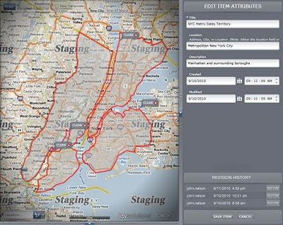
User empowerment is a big push in Visual Fusion 5.0 (available this fall), and that goes hand in hand with context (obligatory Tufte quote: "Context builds meaning"). So in addition to the geographic draw tools available in the SharePoint new item interface, you can create or modify data directly in the Visual Fusion interface -right there in the application; within the context of the rest of your data.
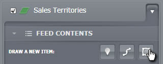
You can...
- Draw new map data from within your application and assign it SharePoint (or whatever database) attributes
- Edit items that you created in SharePoint (or the stuff you created in the bullet above)
- Track changes made to an item in its lifetime and optionally restore it to a historic bookmark

Something need updated or removed? Did a territory change or some attribute need to be modified. Just go ahead and fix that yourself.

They did what?! Wiki-like restore points let you track the evolution of an item.
No comments:
Post a Comment